Hex Mayflies
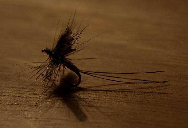
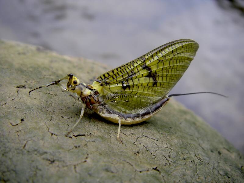
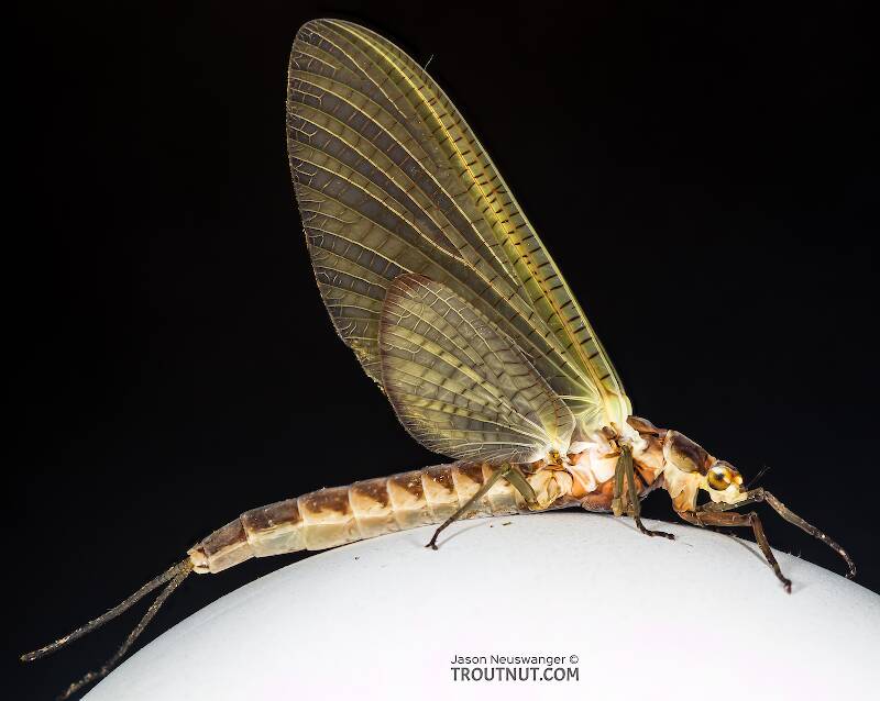
Hexagenia limbata
The famous nocturnal Hex hatch of the Midwest (and a few other lucky locations) stirs to the surface mythically large brown trout that only touch streamers for the rest of the year.
Featured on the forum
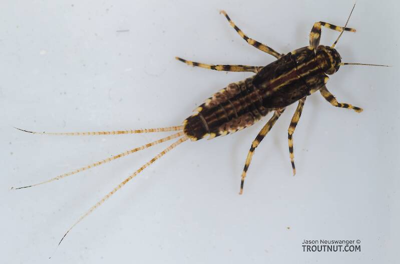
This is an interesting one. Following the keys in Merritt R.W., Cummins, K.W., and Berg, M.B. (2019) and Jacobus et al. (2014), it keys clearly to Ephemerella. Jacobus et al provide a key to species, but some of the characteristics are tricky to interpret without illustrations. If I didn't make any mistakes, this one keys to Ephemerella mucronata, which has not previously been reported any closer to here than Montana and Alberta. The main character seems to fit well: "Abdominal terga with prominent, paired, subparallel, spiculate ridges." Several illustrations or descriptions of this holarctic species from the US and Europe seem to match, including the body length, tarsal claws and denticles, labial palp, and gill shapes. These sources include including Richard Allen's original description of this species in North America under the now-defunct name E. moffatae in Allen RK (1977) and the figures in this description of the species in Italy.
Troutnut is a project started in 2003 by salmonid ecologist Jason "Troutnut" Neuswanger to help anglers and
fly tyers unabashedly embrace the entomological side of the sport. Learn more about Troutnut or
support the project for an enhanced experience here.
FisherOfMen on Mar 8, 2012March 8th, 2012, 5:25 pm EST
I've been trying to find the best way to scout water via the internet, and it seems google earth is the best bet. I've tried Google Maps, Bing Bird's Eye (which was pretty cool, could almost read license plate numbers) and the NYDEC Interactive Mapper, Satellite Imagery that zooms closer than Google Maps and is very clear.
Just how good is Google Earth? How close can you get, and how great is the 3D feature? I have heard people swear by it, but it seems what they say is either too good to be true, or I'm really missing out on some awesome tools by not having Google Earth.
I'm trying to persuade my dad to let me download it on one of our other computers because my desktop is too slow to run the program, and I guess it'd be nice to know whether or not it's really worth the trouble. Any info would be great!
"Nothing makes a fish bigger than almost being caught." -Author Unknown
All that is necessary for the triumph of evil is that good men do nothing. -Edmund Burke
All that is necessary for the triumph of evil is that good men do nothing. -Edmund Burke
Czoom on Mar 12, 2012March 12th, 2012, 12:47 pm EDT
Yeah it is really good. Every computer should have it installed. Not sure why your did is so scared of it? Its a great program made by a great company.
FisherOfMen on Mar 13, 2012March 13th, 2012, 4:10 pm EDT
Thanks - it's not really the program, he just assumes I destroy every electronic thing I touch. All based on some unfortunate incidents some years ago...;)
"Nothing makes a fish bigger than almost being caught." -Author Unknown
All that is necessary for the triumph of evil is that good men do nothing. -Edmund Burke
All that is necessary for the triumph of evil is that good men do nothing. -Edmund Burke
Oldredbarn on Mar 14, 2012March 14th, 2012, 9:18 am EDT
I'm more a boots on the ground type angler myself. :) I feel that the more folks rely on GPS and things like google earth for their experiences the more they are likely to lose their innate sense of direction and will become so lost in the woods they will never find the stream and I won't have to deal with their high-tech shenanigans anywhere near my fishing hole...;)
Well...That's not totally true...A few years back, just after mid-night, I came across two fellas who were so lost they thought they were going to have to spend the night sleeping in the woods...Though I am the son of a navigator the only technology I had in my favor was a flash light...I thought they were going to kiss me when I told them I knew how to find my car...:) No sexton, no loran, no compas, no GPS, or google...I gave one of them one of my flashlights, licked the end of my index finger and stuck it up in the air to ascertain wind direction and turned and headed off in to the woods with my little lost ducklings in tow...:)
Spence
"Even when my best efforts fail it's a satisfying challenge, and that, after all, is the essence of fly fishing." -Chauncy Lively
"Envy not the man who lives beside the river, but the man the river flows through." Joseph T Heywood
"Envy not the man who lives beside the river, but the man the river flows through." Joseph T Heywood
CaseyP on Mar 14, 2012March 14th, 2012, 1:43 pm EDT
Google Earth is great for the very beginnings of scouting a stream, but then YOYO. it doesn't show property lines, posted sections, or all the parking spots. lots of places are only shown with pictures 4 or 5 years old, and lots more don't have the latest resolutions, so you can't necessarily get really close.
it does show the bridges and the intersections. if it's a winter shot, it can show the riffles and pools, depending on how big the stream is and how deep the water was that day.
so tell your dad that everyone in the world uses Google Earth, and even this distrustful Luddite (Wikki that one!) manages to live with it and love it.
"You can observe a lot by watching." Yogi Berra
FisherOfMen on Mar 15, 2012March 15th, 2012, 9:23 am EDT
I'm sorta the same way there, Spence. I don't want to have the "virtual" wilderess experience, I just want to figure out what's what to make best use of my time (and using ma&pa's vehicles) ;)
When I hunt, I carry a compass, but rarely use it even when 1/2 or more from the nearest trail. I'm never ".05 a degree" accurate, but if I run around in the woods willy-nilly (red squirrel hunting)I can give you the general direction where I came from, so no worries there. Plus this whole river thing makes it easy - just follow the river! It will be a sad day if I ever get lost while fly fishing!
But there probably was a bit more excitement before all of this technology. I recently discovered this huge pool via satellite, not by coming across it on foot. That takes some of the mystery and suspense out of "never knowing what's beyond the river bend".
"Nothing makes a fish bigger than almost being caught." -Author Unknown
All that is necessary for the triumph of evil is that good men do nothing. -Edmund Burke
All that is necessary for the triumph of evil is that good men do nothing. -Edmund Burke
Oldredbarn on Mar 15, 2012March 15th, 2012, 10:30 am EDT
it does show the bridges and the intersections. if it's a winter shot, it can show the riffles and pools, depending on how big the stream is and how deep the water was that day.
Casey,
I'm wondering if when you use that little "street-level" character and he's near a blue-ribbon stream if he has a fly rod in his hand? :)
You know they have folks driving around taking those street level photos and I googled my mother's place and when I hit the "street-view" I actually saw two of my niece's and a neighbor girl standing in the drive behind my mother's van...I was a tad concerned...Since you drove him to a dictionary for "Luddite" maybe he'll return for Orwellian? :)
Spence
"Even when my best efforts fail it's a satisfying challenge, and that, after all, is the essence of fly fishing." -Chauncy Lively
"Envy not the man who lives beside the river, but the man the river flows through." Joseph T Heywood
"Envy not the man who lives beside the river, but the man the river flows through." Joseph T Heywood
FisherOfMen on Mar 15, 2012March 15th, 2012, 11:38 am EDT
Just got it on my mom's laptop, and it's very cool, but I only had a minture to play with it before she wanted to do her online banking :P
The quality isn't nearly what I'd hoped, but I'm wondering if that's more of an internet speed problem than satellite resolution problem. I'll figure it out!
The quality isn't nearly what I'd hoped, but I'm wondering if that's more of an internet speed problem than satellite resolution problem. I'll figure it out!
"Nothing makes a fish bigger than almost being caught." -Author Unknown
All that is necessary for the triumph of evil is that good men do nothing. -Edmund Burke
All that is necessary for the triumph of evil is that good men do nothing. -Edmund Burke
FisherOfMen on Mar 15, 2012March 15th, 2012, 11:40 am EDT
Spence-
It'd be amazing if you found one of those bridge pics with you in the river hauling in a fish!
It'd be amazing if you found one of those bridge pics with you in the river hauling in a fish!
"Nothing makes a fish bigger than almost being caught." -Author Unknown
All that is necessary for the triumph of evil is that good men do nothing. -Edmund Burke
All that is necessary for the triumph of evil is that good men do nothing. -Edmund Burke
Oldredbarn on Mar 15, 2012March 15th, 2012, 1:22 pm EDT
Spence-
It'd be amazing if you found one of those bridge pics with you in the river hauling in a fish!
Yeah! It would be a real hoot if I was doing it over by Spencer's Bridge on the Little Manistee...:)
I like the new profile pic!
Spence
"Even when my best efforts fail it's a satisfying challenge, and that, after all, is the essence of fly fishing." -Chauncy Lively
"Envy not the man who lives beside the river, but the man the river flows through." Joseph T Heywood
"Envy not the man who lives beside the river, but the man the river flows through." Joseph T Heywood
Crepuscular on Mar 16, 2012March 16th, 2012, 5:56 am EDT
FisherOfMen, If you are really interested in playing around with aerial photos for that kind of stuff you may want to try out ESRI's on line GIS mapping.http://www.arcgis.com/home/ You can overlay GIS layers from places such as the NY DEC that show fishing access or water quality data such and stream designations http://gis.ny.gov/gisdata/inventories/member.cfm?OrganizationID=529. I like it better than Google Earth because you have better control of the map content.I'm not super familiar with the NY datasets put PA has layers that show trout reproduction in specific stream reaches along with other water quality data and flow data.
Spence , I hope you didn't have any of those storms last evening
Spence , I hope you didn't have any of those storms last evening
Oldredbarn on Mar 16, 2012March 16th, 2012, 6:46 am EDT
Spence , I hope you didn't have any of those storms last evening
Thanks for the concern! It was a close one...Dexter is just a bit west of Ann Arbor and my smallie river the Huron runs right through it. My office is 20 or so minutes north of Ann Arbor and my home is 10 miles east of my office...It got really dark and was raining when we left for home...My wife and I were heading out for the gym and my mother called to see if I was ok...Strange thing was everything was really slow moving and there was a great deal of lightening but little wind where I was at. North of us the sky was fairly clear but darker than hell south of us...Funny thing is my mom isn't the best when it comes to directions, she lives near the airport straight east of Ann Arbor, and the damn thing was really more her way than mine...I called her back when we left the gym to see if she was still with us or visiting Oz...;) She was ok...
The video from last night was scary.
Spence
"Even when my best efforts fail it's a satisfying challenge, and that, after all, is the essence of fly fishing." -Chauncy Lively
"Envy not the man who lives beside the river, but the man the river flows through." Joseph T Heywood
"Envy not the man who lives beside the river, but the man the river flows through." Joseph T Heywood
Stickstring on Jul 30, 2019July 30th, 2019, 6:45 pm EDT
Sorry for raising the dead forum, but I wanted to throw out the OnX mapping system as well. This allows you to overlap aerial photos with available land ownership.
As far as scouting, what does everyone look for in an aerial photos?
As far as scouting, what does everyone look for in an aerial photos?
Roguerat on Jul 30, 2019July 30th, 2019, 10:43 pm EDT
works for me-
When 'trout-driving by computer' I'll check for outside bends (deep water, no wading), inside bends, gravel flats and riffle water (usually wadeable and show up pretty well)and any 2-tracks or other 'roads' that could mean access...I'll also pull up plat map/ownership websites for a County or Township that usually shows State or Federal lands along a given waterway, aka public access.
2-cents,
Roguerat
'Less is more...'
Ludwig Mies Vande Rohe
Troutnut on Jul 31, 2019July 31st, 2019, 6:16 am EDT
That's a good point Stickstring. I love OnX. I still use Google Earth quite a bit when I'm strictly interested in visualizing the landscape, but I use OnX all the time to check land ownership/access. OnX with the "download maps for offline use" feature has almost completely replaced my Garmin GPS in the field on both hunting and fishing trips. The high quality imagery on my high quality phone screen is just too valuable compared to the Garmin screens that still look like cell phones from the 1990s for some reason.
Jason Neuswanger, Ph.D.
Troutnut and salmonid ecologist
Troutnut and salmonid ecologist
Strmanglr on Aug 1, 2019August 1st, 2019, 3:14 am EDT
@Roguerat, can you post the sites you check for ownership. I'm guessing you've done this in Michigan. I'm always wondering and don't want to trespass.
Jmd123 on Aug 1, 2019August 1st, 2019, 5:07 am EDT
"@Roguerat, can you post the sites you check for ownership. I'm guessing you've done this in Michigan. I'm always wondering and don't want to trespass."
Thank goodness we have so much public land and waters here in MI! Though, some private areas are probably higher quality if you "keep the riff-raff out". I know that my local streams get pounded at the easy access points, so if you do get permission, you might just find some underfished waters. But if not, at least there's the Huron/Manistee NF, plus the state forests (I have some Alpena State Forest land just across the road from me at my new place, and there are some brookie waters to be explored...).
Tight lines wherever you end up fishing!
Jonathon
No matter how big the one you just caught is, there's always a bigger one out there somewhere...
Roguerat on Aug 1, 2019August 1st, 2019, 6:32 am EDT
One site I've made much use of is the Newaygo County GIS map viewer, a satellite view with Township, section, and plot ownership superimposed on it. I've scoped the Muskegon River thoroughly and have all of the MI DNR owned parcels (a LOT of them, ditto on what Jonathon said!) noted along with adjacent roads or 2-tracks, etc, for drive-in access. I would guess that most MI Counties would have similar sites, maybe even other States' Counties?
Fishy stuff- its slow, warm, and early-morning on the water if at all here in W MI...I still have my antipathy for the 'yaks and such so being out long before they even consider it is the plan. I did have 2 good Family Time forays into the UP and was able to spend some time on the Whitefish and Sturgeon (above Nahma Junction), made good use of my Patagonia cleats, and had great weather. Can't ask for more!
Roguerat
'Less is more...'
Ludwig Mies Vande Rohe
Quick Reply
Related Discussions
Topic
Replies
Last Reply

